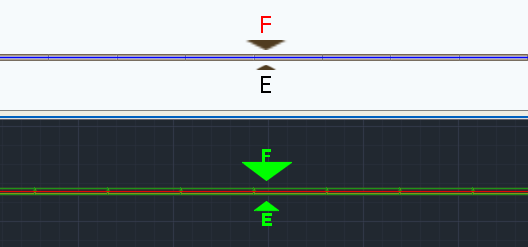
Elevation markers are labels that appear on wall segments in ICE 2D plan view and ICEcad, indicating which elevation is associated with that wall segment. If you insert multiple elevations, each side of your wall segment has a separate elevation. Therefore, one elevation marker appears on each side of the wall segment.

Elevation Markers with different Elevation Marker Scales
In the Properties Editor, there are three elevation properties that you can use to position or re-size elevation markers.
•Elevation Marker Horizontal Offset: Move the elevation marker horizontally along the wall segment.
•Elevation Marker Vertical Offset: Shift the elevation marker vertically so that it moves closer to or further away from the wall segment.
•Elevation Marker Scale: Change the size of the elevation marker.
Topic last updated on 3/16/2023.
Related Links: